Location Maps
ReliefWeb has produced a series of Location Maps for use by OCHA and partnering organizations. The ReliefWeb Location Map is a map that highlights a country, its capital and the surrounding regions. These maps are intended to provide the UN community, as well as the humanitarian community at large, with a product that is useful to put into documents, reports, briefing notes, and websites in providing reference to locations of interest.
Want to use these maps in a report or on your website? Please see the map permission page first.
A | B | C | D | E | F | G | H | I | J | K | L | M | N | O | P | Q | R | S | T | U | V | W | X | Y | Z
- Afghanistan: Location Map (2013) - PDF - SVG - PNG 250px - PNG 500px - PNG 1000px | OCHA Reference Map
- Albania: Location Map (2013) - PDF - SVG - PNG 250px - PNG 500px - PNG 1000px
- Algeria: Location Map (2013) - PDF - SVG - PNG 250px - PNG 500px - PNG 1000px
- Andorra: Location Map (2013) - PDF - SVG - PNG 250px - PNG 500px - PNG 1000px
- Angola: Location Map (2013) - PDF - SVG - PNG 250px - PNG 500px - PNG 1000px
- Anguilla: Location Map (2013) - PDF - SVG - PNG 250px - PNG 500px - PNG 1000px
- Antigua and Barbuda: Location Map (2013) - PDF - SVG - PNG 250px - PNG 500px - PNG 1000px
- Argentina: Location Map (2013) - PDF - SVG - PNG 250px - PNG 500px - PNG 1000px
- Armenia: Location Map (2013) - PDF - SVG - PNG 250px - PNG 500px - PNG 1000px
- Australia: Location Map (2013) - PDF - SVG - PNG 250px - PNG 500px - PNG 1000px
- Austria: Location Map (2013) - PDF - SVG - PNG 250px - PNG 500px - PNG 1000px
- Azerbaijan: Location Map (2013) - PDF - SVG - PNG 250px - PNG 500px - PNG 1000px
- Bahamas: Location Map (2013) - PDF - SVG - PNG 250px - PNG 500px - PNG 1000px
- Bahrain: Location Map (2013) - PDF - SVG - PNG 250px - PNG 500px - PNG 1000px
- Bangladesh: Location Map (2013) - PDF - SVG - PNG 250px - PNG 500px - PNG 1000px
- Barbados: Location Map (2013) - PDF - SVG - PNG 250px - PNG 500px - PNG 1000px
- Belarus: Location Map (2013) - PDF - SVG - PNG 250px - PNG 500px - PNG 1000px
- Belgium: Location Map (2013) - PDF - SVG - PNG 250px - PNG 500px - PNG 1000px
- Belize: Location Map (2013) - PDF - SVG - PNG 250px - PNG 500px - PNG 1000px
- Benin: Location Map (2011) - PDF - SVG - PNG 250px - PNG 500px - PNG 1000px
- Bhutan: Location Map (2013) - PDF - SVG - PNG 250px - PNG 500px - PNG 1000px
- Bolivia: Location Map (2011) - PDF - SVG - PNG 250px - PNG 500px - PNG 1000px
- Bonaire, Saint Eustatius and Saba (NL): Location Map (2017) - PDF - SVG - PNG 250px - PNG 500px - PNG 1000px
- Bosnia and Herzegovina: Location Map (2013) - PDF - SVG - PNG 250px - PNG 500px - PNG 1000px
- Botswana: Location Map (2013) - PDF - SVG - PNG 250px - PNG 500px - PNG 1000px
- Brazil: Location Map (2013) - PDF - SVG - PNG 250px - PNG 500px - PNG 1000px
- British Virgin Islands: Location Map (2013) - PDF - SVG - PNG 250px - PNG 500px - PNG 1000px
- Brunei Darussalam: Location Map (2013) - PDF - SVG - PNG 250px - PNG 500px - PNG 1000px
- Bulgaria: Location Map (2013) - PDF - SVG - PNG 250px - PNG 500px - PNG 1000px
- Burkina Faso: Location Map (2013) - PDF - SVG - PNG 250px - PNG 500px - PNG 1000px | OCHA Reference Map
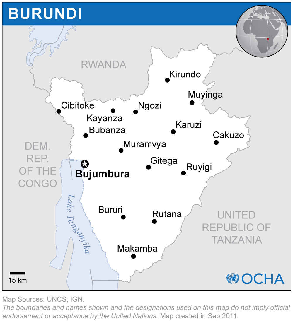
- Burundi: Location Map (2011) - PDF - SVG - PNG 250px - PNG 500px - PNG 1000px | OCHA Reference Map
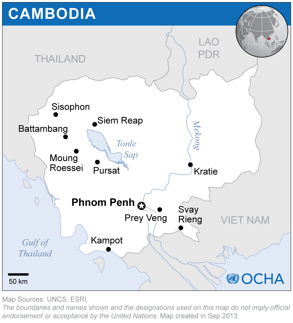
- Cambodia: Location Map (2013) - PDF - SVG - PNG 250px - PNG 500px - PNG 1000px
- Cameroon: Location Map (2013) - PDF - SVG - PNG 250px - PNG 500px - PNG 1000px
- Canada: Location Map (2013) - PDF - SVG - PNG 250px - PNG 500px - PNG 1000px
- Cape Verde: Location Map (2013) - PDF - SVG - PNG 250px - PNG 500px - PNG 1000px
- Central African Republic: Location Map (2013) - PDF - SVG - PNG 250px - PNG 500px - PNG 1000px | OCHA Reference Map
- Chad: Location Map (2013) - PDF - SVG - PNG 250px - PNG 500px - PNG 1000px | OCHA Reference Map
- Chile: Location Map (2013) - PDF - SVG - PNG 250px - PNG 500px - PNG 1000px
- China: Location Map (2013) - PDF - SVG - PNG 250px - PNG 500px - PNG 1000px
- Colombia: Location Map (2013) - PDF - SVG - PNG 250px - PNG 500px - PNG 1000px
- Comoros: Location Map (2013) - PDF - SVG - PNG 250px - PNG 500px - PNG 1000px
- Congo: Location Map (2011) - PDF - SVG - PNG 250px - PNG 500px - PNG 1000px | OCHA Reference Map
- Cook Islands: Location Map (2013) - PDF - SVG - PNG 250px - PNG 500px - PNG 1000px
- Costa Rica: Location Map (2013) - PDF - SVG - PNG 250px - PNG 500px - PNG 1000px
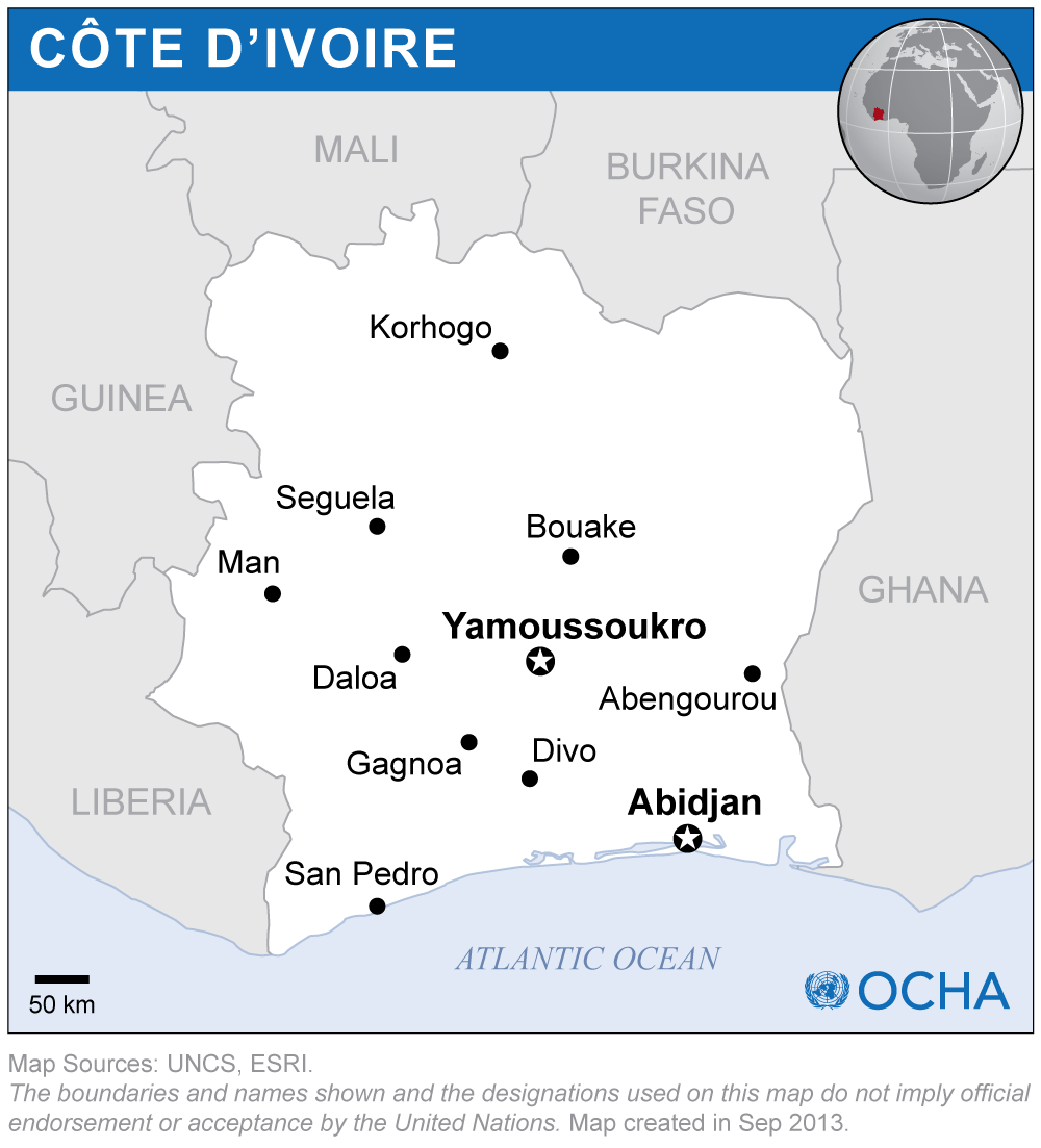
- Côte d'Ivoire: Location Map (2013) - PDF - SVG - PNG 250px - PNG 500px - PNG 1000px | OCHA Reference Map
- Croatia: Location Map (2013) - PDF - SVG - PNG 250px - PNG 500px - PNG 1000px
- Cuba: Location Map (2011) - PDF - SVG - PNG 250px - PNG 500px - PNG 1000px
- Cyprus: Location Map (2013) - PDF - SVG - PNG 250px - PNG 500px - PNG 1000px
- Czechia: Location Map (2017) - PDF - SVG - PNG 250px - PNG 500px - PNG 1000px
- Democratic People's Republic of Korea: Location Map (2013) - PDF - SVG - PNG 250px - PNG 500px - PNG 1000px
- Democratic Republic of the Congo: Location Map (2013) - PDF - SVG - PNG 250px - PNG 500px - PNG 1000px | OCHA Reference Map
- Denmark: Location Map (2013) - PDF - SVG - PNG 250px - PNG 500px - PNG 1000px
- Djibouti: Location Map (2013) - PDF - SVG - PNG 250px - PNG 500px - PNG 1000px
- Dominica: Location Map (2013) - PDF - SVG - PNG 250px - PNG 500px - PNG 1000px
- Dominican Republic: Location Map (2013) - PDF - SVG - PNG 250px - PNG 500px - PNG 1000px
- Ecuador: Location Map (2013) - PDF - SVG - PNG 250px - PNG 500px - PNG 1000px
- Egypt: Location Map (2013) - PDF - SVG - PNG 250px - PNG 500px - PNG 1000px
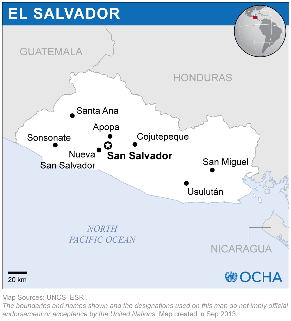
- El Salvador: Location Map (2013) - PDF - SVG - PNG 250px - PNG 500px - PNG 1000px | OCHA Reference Map
- Equatorial Guinea: Location Map (2013) - PDF - SVG - PNG 250px - PNG 500px - PNG 1000px
- Eritrea: Location Map (2013) - PDF - SVG - PNG 250px - PNG 500px - PNG 1000px
- Estonia: Location Map (2013) - PDF - SVG - PNG 250px - PNG 500px - PNG 1000px
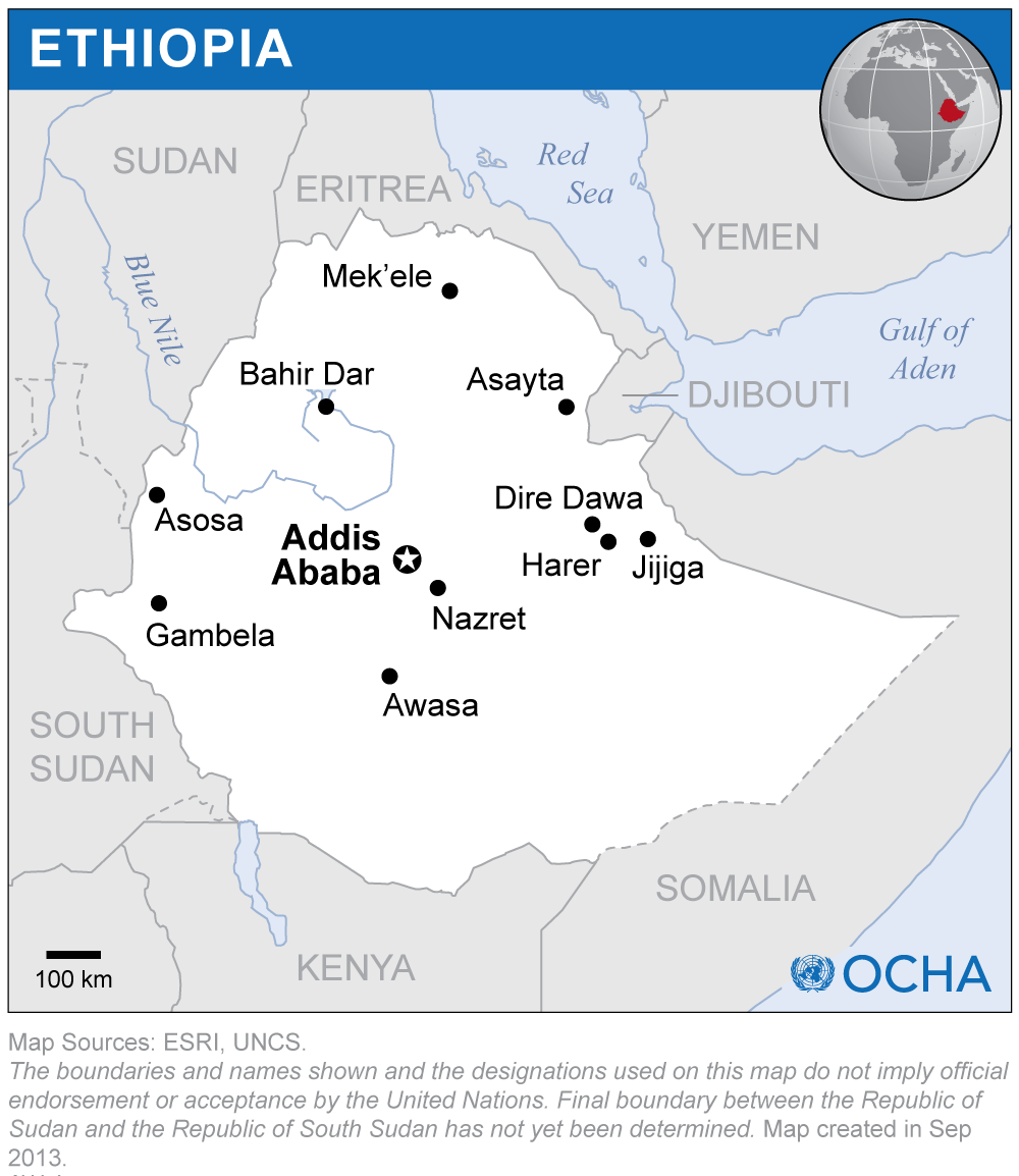
- Ethiopia: Location Map (2013) - PDF - SVG - PNG 250px - PNG 500px - PNG 1000px
- Fiji: Location Map (2013) - PDF - SVG - PNG 250px - PNG 500px - PNG 1000px
- Finland: Location Map (2013) - PDF - SVG - PNG 250px - PNG 500px - PNG 1000px
- France: Location Map (2013) - PDF - SVG - PNG 250px - PNG 500px - PNG 1000px
- French Polynesia (FR) (2013) - PDF - SVG - PNG 250px - PNG 500px - PNG 1000px
- Gabon: Location Map (2013) - PDF - SVG - PNG 250px - PNG 500px - PNG 1000px
- Gambia: Location Map (2013) - PDF - SVG - PNG 250px - PNG 500px - PNG 1000px
- Georgia: Location Map (2013) - PDF - SVG - PNG 250px - PNG 500px - PNG 1000px
- Germany: Location Map (2013) - PDF - SVG - PNG 250px - PNG 500px - PNG 1000px
- Ghana: Location Map (2013) - PDF - SVG - PNG 250px - PNG 500px - PNG 1000px
- Greece: Location Map (2013) - PDF - SVG - PNG 250px - PNG 500px - PNG 1000px
- Grenada: Location Map (2013) - PDF - SVG - PNG 250px - PNG 500px - PNG 1000px
- Guam: Location Map (2013) - PDF - SVG - PNG 250px - PNG 500px - PNG 1000px
- Guadaloupe (FR): Location Map (2013) - PDF - SVG - PNG 250px - PNG 500px - PNG 1000px
- Guatemala: Location Map (2013) - PDF - SVG - PNG 250px - PNG 500px - PNG 1000px | OCHA Reference Map
- Guinea: Location Map (2013) - PDF - SVG - PNG 250px - PNG 500px - PNG 1000px | OCHA Reference Map
- Guinea-Bissau: Location Map (2013) - PDF - SVG - PNG 250px - PNG 500px - PNG 1000px
- Guyana: Location Map (2013) - PDF - SVG - PNG 250px - PNG 500px - PNG 1000px
- Haiti: Location Map (2013) - PDF - SVG - PNG 250px - PNG 500px - PNG 1000px | OCHA Reference Map
- Honduras: Location Map (2011) - PDF - SVG - PNG 250px - PNG 500px - PNG 1000px
- Hungary: Location Map (2013) - PDF - SVG - PNG 250px - PNG 500px - PNG 1000px
- Iceland: Location Map (2013) - PDF - SVG - PNG 250px - PNG 500px - PNG 1000px
- India: Location Map (2013) - PDF - SVG - PNG 250px - PNG 500px - PNG 1000px
- Indonesia: Location Map (2013) - PDF - SVG - PNG 250px - PNG 500px - PNG 1000px | OCHA Reference Map
- Iran, Islamic Republic of: Location Map (2013) - PDF - SVG - PNG 250px - PNG 500px - PNG 1000px
- Iraq: Location Map (2011) - PDF - SVG - PNG 250px - PNG 500px - PNG 1000px | OCHA Reference Map
- Ireland: Location Map (2013) - PDF - SVG - PNG 250px - PNG 500px - PNG 1000px
- Israel: Location Map (2012) - PDF - SVG - PNG 250px - PNG 500px - PNG 1000px
- Italy: Location Map (2013) - PDF - SVG - PNG 250px - PNG 500px - PNG 1000px
- Jamaica: Location Map (2013) - PDF - SVG - PNG 250px - PNG 500px - PNG 1000px
- Japan: Location Map (2013) - PDF - SVG - PNG 250px - PNG 500px - PNG 1000px
- Jordan: Location Map (2013) - PDF - SVG - PNG 250px - PNG 500px - PNG 1000px
- Kazakhstan: Location Map (2013) - PDF - SVG - PNG 250px - PNG 500px - PNG 1000px
- Kenya: Location Map (2013) - PDF - SVG - PNG 250px - PNG 500px - PNG 1000px | OCHA Reference Map
- Kiribati: Location Map (2013) - PDF - SVG - PNG 250px - PNG 500px - PNG 1000px
- Kuwait: Location Map (2013) - PDF - SVG - PNG 250px - PNG 500px - PNG 1000px
- Krygyzstan: Location Map (2011) - PDF - SVG - PNG 250px - PNG 500px - PNG 1000px | OCHA Reference Map
- Lao People's Democratic Republic: Location Map (2013) - PDF - SVG - PNG 250px - PNG 500px - PNG 1000px | OCHA Reference Map
- Latvia: Location Map (2013) - PDF - SVG - PNG 250px - PNG 500px - PNG 1000px
- Lebanon: Location Map (2011) - PDF - SVG - PNG 250px - PNG 500px - PNG 1000px
- Lesotho: Location Map (2013) - PDF - SVG - PNG 250px - PNG 500px - PNG 1000px
- Liberia: Location Map (2013) - PDF - SVG - PNG 250px - PNG 500px - PNG 1000px
- Libya: Location Map (2013) - PDF - SVG - PNG 250px - PNG 500px - PNG 1000px
- Liechtenstein: Location Map (2013) - PDF - SVG - PNG 250px - PNG 500px - PNG 1000px
- Lithuania: Location Map (2013) - PDF - SVG - PNG 250px - PNG 500px - PNG 1000px
- Luxembourg: Location Map (2013) - PDF - SVG - PNG 250px - PNG 500px - PNG 1000px
- Madagascar: Location Map (2013) - PDF - SVG - PNG 250px - PNG 500px - PNG 1000px | OCHA Reference Map
- Malawi: Location Map (2013) - PDF - SVG - PNG 250px - PNG 500px - PNG 1000px
- Malaysia: Location Map (2013) - PDF - SVG - PNG 250px - PNG 500px - PNG 1000px
- Maldives: Location Map (2013) - PDF - SVG - PNG 250px - PNG 500px - PNG 1000px
- Mali: Location Map (2013) - PDF - SVG - PNG 250px - PNG 500px - PNG 1000px
- Malta: Location Map (2013) - PDF - SVG - PNG 250px - PNG 500px - PNG 1000px
- Marshall Islands: Location Map (2013) - PDF - SVG - PNG 250px - PNG 500px - PNG 1000px
- Martinique (FR): Location Map (2013) - PDF - SVG - PNG 250px - PNG 500px - PNG 1000px
- Mauritania: Location Map (2013) - PDF - SVG - PNG 250px - PNG 500px - PNG 1000px
- Mauritius: Location Map (2013) - PDF - SVG - PNG 250px - PNG 500px - PNG 1000px
- Mexico: Location Map (2013) - PDF - SVG - PNG 250px - PNG 500px - PNG 1000px
- Micronesia, Federated States of: Location Map (2013) - PDF - SVG - PNG 250px - PNG 500px - PNG 1000px
- Moldova, Republic of: Location Map (2013) - PDF - SVG - PNG 250px - PNG 500px - PNG 1000px
- Mongolia: Location Map (2013) - PDF - SVG - PNG 250px - PNG 500px - PNG 1000px | OCHA Reference Map
- Montenegro: Location Map (2013) - PDF - SVG - PNG 250px - PNG 500px - PNG 1000px
- Montserrat: Location Map (2013) - PDF - SVG - PNG 250px - PNG 500px - PNG 1000px
- Morocco: Location Map (2013) - PDF - SVG - PNG 250px - PNG 500px - PNG 1000px
- Mozambique: Location Map (2013) - PDF - SVG - PNG 250px - PNG 500px - PNG 1000px
- Myanmar: Location Map (2013) - PDF - SVG - PNG 250px - PNG 500px - PNG 1000px
- Namibia: Location Map (2013) - PDF - SVG - PNG 250px - PNG 500px - PNG 1000px | OCHA Reference Map
- Nauru: Location Map (2013) - PDF - SVG - PNG 250px - PNG 500px - PNG 1000px
- Nepal: Location Map - PDF - SVG - PNG 250px - PNG 500px - PNG 1000px (2013) | OCHA Reference Map
- Netherlands: Location Map (2013) - PDF - SVG - PNG 250px - PNG 500px - PNG 1000px
- New Zealand: Location Map (2013) - PDF - SVG - PNG 250px - PNG 500px - PNG 1000px
- Nicaragua: Location Map (2013) - PDF - SVG - PNG 250px - PNG 500px - PNG 1000px
- Niger: Location Map (2011) - PDF - SVG - PNG 250px - PNG 500px - PNG 1000px
- Nigeria: Location Map (2013) - PDF - SVG - PNG 250px - PNG 500px - PNG 1000px
- Niue: Location Map (2013) - PDF - SVG - PNG 250px - PNG 500px - PNG 1000px
- Northern Mariana Islands (USA): Location Map (2017) - PDF - SVG - PNG 250px - PNG 500px - PNG 1000px
- Norway: Location Map (2013) - PDF - SVG - PNG 250px - PNG 500px - PNG 1000px
- occupied Palestinian territory: Location Map (2013) - PDF - SVG - PNG 250px - PNG 500px - PNG 1000px | OCHA Reference Map
- Oman: Location Map (2013) - PDF - SVG - PNG 250px - PNG 500px - PNG 1000px
- Pakistan: Location Map (2013) - PDF - SVG - PNG 250px - PNG 500px - PNG 1000px | OCHA Reference Map
- Palau: Location Map (2013) - PDF - SVG - PNG 250px - PNG 500px - PNG 1000px
- Panama: Location Map (2011) - PDF - SVG - PNG 250px - PNG 500px - PNG 1000px
- Papua New Guinea: Location Map (2013) - PDF - SVG - PNG 250px - PNG 500px - PNG 1000px
- Paraguay: Location Map (2012) - PDF - SVG - PNG 250px - PNG 500px - PNG 1000px
- Peru: Location Map (2011) - PDF - SVG - PNG 250px - PNG 500px - PNG 1000px
- Philippines: Location Map (2013) - PDF - SVG - PNG 250px - PNG 500px - PNG 1000px | OCHA Reference Map
- Poland: Location Map (2013) - PDF - SVG - PNG 250px - PNG 500px - PNG 1000px
- Portugal: Location Map (2013) - PDF - SVG - PNG 250px - PNG 500px - PNG 1000px
- Puerto Rico: Loction Map (2013) - PDF - SVG - PNG 250px - PNG 500px - PNG 1000px
- Qatar: Location Map (2013) - PDF - SVG - PNG 250px - PNG 500px - PNG 1000px
- Republic of Korea: Location Map (2013) - PDF - SVG - PNG 250px - PNG 500px - PNG 1000px
- Réunion (FR): Location Map (2013) - PDF - SVG - PNG 250px - PNG 500px - PNG 1000px
- Romania: Location Map (2013) - PDF - SVG - PNG 250px - PNG 500px - PNG 1000px
- Russian Federation: Location Map (2013) - PDF - SVG - PNG 250px - PNG 500px - PNG 1000px
- Rwanda: Location Map (2011) - PDF - SVG - PNG 250px - PNG 500px - PNG 1000px
- Saint Barthélemy (Fr): Location Map (2017) - PDF - SVG - PNG 250px - PNG 500px - PNG 1000px
- Saint Kitts and Nevis: Location Map (2013) - PDF - SVG - PNG 250px - PNG 500px - PNG 1000px
- Saint Lucia: Location Map (2013) - PDF - SVG - PNG 250px - PNG 500px - PNG 1000px
- Saint Vincent and the Grenadines: Location Map (2013) - PDF - SVG - PNG 250px - PNG 500px - PNG 1000px
- Samoa: Location Map (2013) - PDF - SVG - PNG 250px - PNG 500px - PNG 1000px
- San Marino: Location Map (2013) - PDF - SVG - PNG 250px - PNG 500px - PNG 1000px
- Sao Tome and Principe: Location Map (2013) - PDF - SVG - PNG 250px - PNG 500px - PNG 1000px
- Saudi Arabia: Location Map (2013) - PDF - SVG - PNG 250px - PNG 500px - PNG 1000px
- Senegal: Location Map (2011) - PDF - SVG - PNG 250px - PNG 500px - PNG 1000px
- Serbia: Location Map (2013) - PDF - SVG - PNG 250px - PNG 500px - PNG 1000px
- Seychelles: Location Map (2013) - PDF - SVG - PNG 250px - PNG 500px - PNG 1000px
- Sierra Leone: Location Map (2012) - PDF - SVG - PNG 250px - PNG 500px - PNG 1000px
- Singapore: Location Map (2013) - PDF - SVG - PNG 250px - PNG 500px - PNG 1000px
- Slovakia: Location Map (2013) - PDF - SVG - PNG 250px - PNG 500px - PNG 1000px
- Slovenia: Location Map (2013) - PDF - SVG - PNG 250px - PNG 500px - PNG 1000px
- Solomon Islands: Location Map (2012) - PDF - SVG - PNG 250px - PNG 500px - PNG 1000px
- Somalia: Location Map (2011) - PDF - SVG - PNG 250px - PNG 500px - PNG 1000px | OCHA Reference Map
- South Africa: Location Map (2013) - PDF - SVG - PNG 250px - PNG 500px - PNG 1000px
- South Sudan: Location Map (2011) - PDF - SVG - PNG 250px - PNG 500px - PNG 1000px
- Spain: Location Map (2013) - PDF - SVG - PNG 250px - PNG 500px - PNG 1000px
- Sri Lanka: Location Map (2011) - PDF - SVG - PNG 250px - PNG 500px - PNG 1000px | OCHA Reference Map
- Sudan: Location Map (2011) - PDF - SVG - PNG 250px - PNG 500px - PNG 1000px | OCHA Reference Map
- Suriname: Location Map (2013) - PDF - SVG - PNG 250px - PNG 500px - PNG 1000px
- Swaziland: Location Map (2013) - PDF - SVG - PNG 250px - PNG 500px - PNG 1000px
- Sweden: Location Map (2013) - PDF - SVG - PNG 250px - PNG 500px - PNG 1000px
- Switzerland: Location Map (2013) - PDF - SVG - PNG 250px - PNG 500px - PNG 1000px
- Syrian Arab Republic: Location Map (2013) - PDF - SVG - PNG 250px - PNG 500px - PNG 1000px | OCHA Reference Map
- Tajikistan: Location Map (2013) - PDF - SVG - PNG 250px - PNG 500px - PNG 1000px | OCHA Reference Map
- Thailand: Location Map (2013) - PDF - SVG - PNG 250px - PNG 500px - PNG 1000px
- the former Yugoslav Republic of Macedonia: Location Map (2013) - PDF - SVG - PNG 250px - PNG 500px - PNG 1000px
- Timor-Leste: Location Map (2013) - PDF - SVG - PNG 250px - PNG 500px - PNG 1000px
- Togo: Location Map (2013) - PDF - SVG - PNG 250px - PNG 500px - PNG 1000px
- Tonga: Location Map (2013) - PDF - SVG - PNG 250px - PNG 500px - PNG 1000px
- Trinidad and Tobago: Location Map (2013) - PDF - SVG - PNG 250px - PNG 500px - PNG 1000px
- Tunisia: Location Map (2013) - PDF - SVG - PNG 250px - PNG 500px - PNG 1000px
- Turkey: Location Map (2013) - PDF - SVG - PNG 250px - PNG 500px - PNG 1000px
- Turkmenistan: Location Map (2013) - PDF - SVG - PNG 250px - PNG 500px - PNG 1000px
- Tuvalu: Location Map (2013) - PDF - SVG - PNG 250px - PNG 500px - PNG 1000px
- Uganda: Location Map (2013) - PDF - SVG - PNG 250px - PNG 500px - PNG 1000px | OCHA Reference Map
- Ukraine: Location Map - PDF - SVG - PNG 250px - PNG 500px - PNG 1000px | OCHA Reference Map (2013)
- United Arab Emirates: Location Map (2013) - PDF - SVG - PNG 250px - PNG 500px - PNG 1000px
- United Kingdom of Great Britain and Northern Ireland: Location Map (2013) - PDF - SVG - PNG 250px - PNG 500px - PNG 1000px
- United Republic of Tanzania: Location Map (2013) - PDF - SVG - PNG 250px - PNG 500px - PNG 1000px
- United States of America: Location Map (2013) - PDF - SVG - PNG 250px - PNG 500px - PNG 1000px
- United States Virgin Islands: Location Map (2013) - PDF - SVG - PNG 250px - PNG 500px - PNG 1000px
- Uruguay: Location Map (2013) - PDF - SVG - PNG 250px - PNG 500px - PNG 1000px
- Uzbekistan: Location Map (2011) - PDF - SVG - PNG 250px - PNG 500px - PNG 1000px
- Vanuatu: Location Map (2013) - PDF - SVG - PNG 250px - PNG 500px - PNG 1000px
- Venezuela: Location Map (2013) - PDF - SVG - PNG 250px - PNG 500px - PNG 1000px
- Viet Nam: Location Map (2013) - PDF - SVG - PNG 250px - PNG 500px - PNG 1000px
- Western Sahara: Location Map (2013) - PDF - SVG - PNG 250px - PNG 500px - PNG 1000px
- Yemen: Location Map (2013) - PDF - SVG - PNG 250px - PNG 500px - PNG 1000px | OCHA Reference Map
- Zambia: Location Map (2011) - PDF - SVG - PNG 250px - PNG 500px - PNG 1000px
- Zimbabwe: Location Map (2013) - PDF - SVG - PNG 250px - PNG 500px - PNG 1000px | OCHA Reference Map
